SURVEYING SERVICES
Whether you're looking at a survey in Perth or out in rural Western Australia, or if you're after expert advice on your surveying needs, Scanlan Surveys is here to help you.
Our team of highly experienced and qualified individuals means that your survey needs are always met. From the beginning, we aim to be informative, accurate and efficient, no matter the type of survey. Whether you are looking into subdividing your property and want to know the difference between green title vs survey strata, need a boundary survey to help you install a fence, or are looking for general advice on surveying matters, we’re here to help.
We’re specialists in subdividing land and are here to help make the process a lot easier from start to finish. Our experience means we’re able to give you more information before you start your subdivision and can provide better estimates on what your project will cost to complete.
For more information about the types of surveys we can complete for you and for examples, please see below. If you are still unsure about which survey you require, or if you would like more information about your own survey requirements, contact us on 9250 2261 or complete our online form here.
Advice
Our company aims to be accessible and informative when it comes to both surveying and subdividing land. When you contact our office, our team is dedicated to researching your property and providing accurate, efficient and quality responses to your queries.
We work closely with licensed valuers, building surveyors, strata title consultants and planners, as well as liaise with authorities such as your local council, so when you contact our office with a query, we are able to source a wider range of information to give you the answers you need.
We specialise in subdivision surveys in both the Perth Metropolitan Area as well as in rural regions throughout Western Australia. Our surveying services have enabled our highly qualified and registered surveyors to travel to remote regions throughout our state and even to the Territory of Christmas Island. No matter where you are in Western Australia, when you need advice on surveying, whether is be about a topographic survey, boundary survey, strata plan or any other kind of surveying matter, our team is more than happy to assist. Our surveyors have an extensive knowledge of surveying practices and can assist with your surveying needs including survey works relating to:
- Boundary Surveys
- Contour and Feature Surveys
- Green Title Subdivisions
- Survey Strata Subdivisions
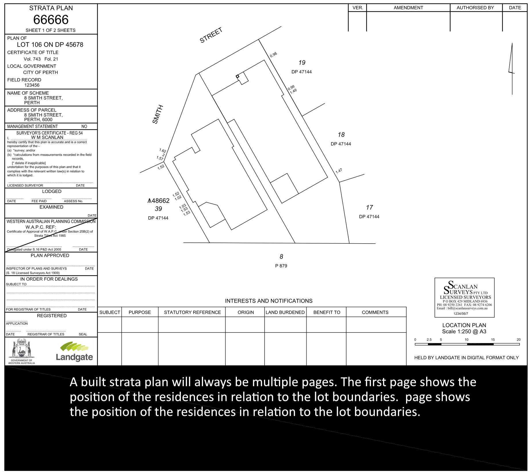
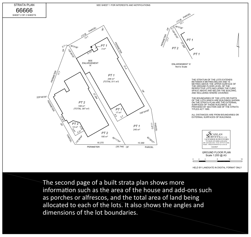
- Built Strata / Strata Title Subdivisions
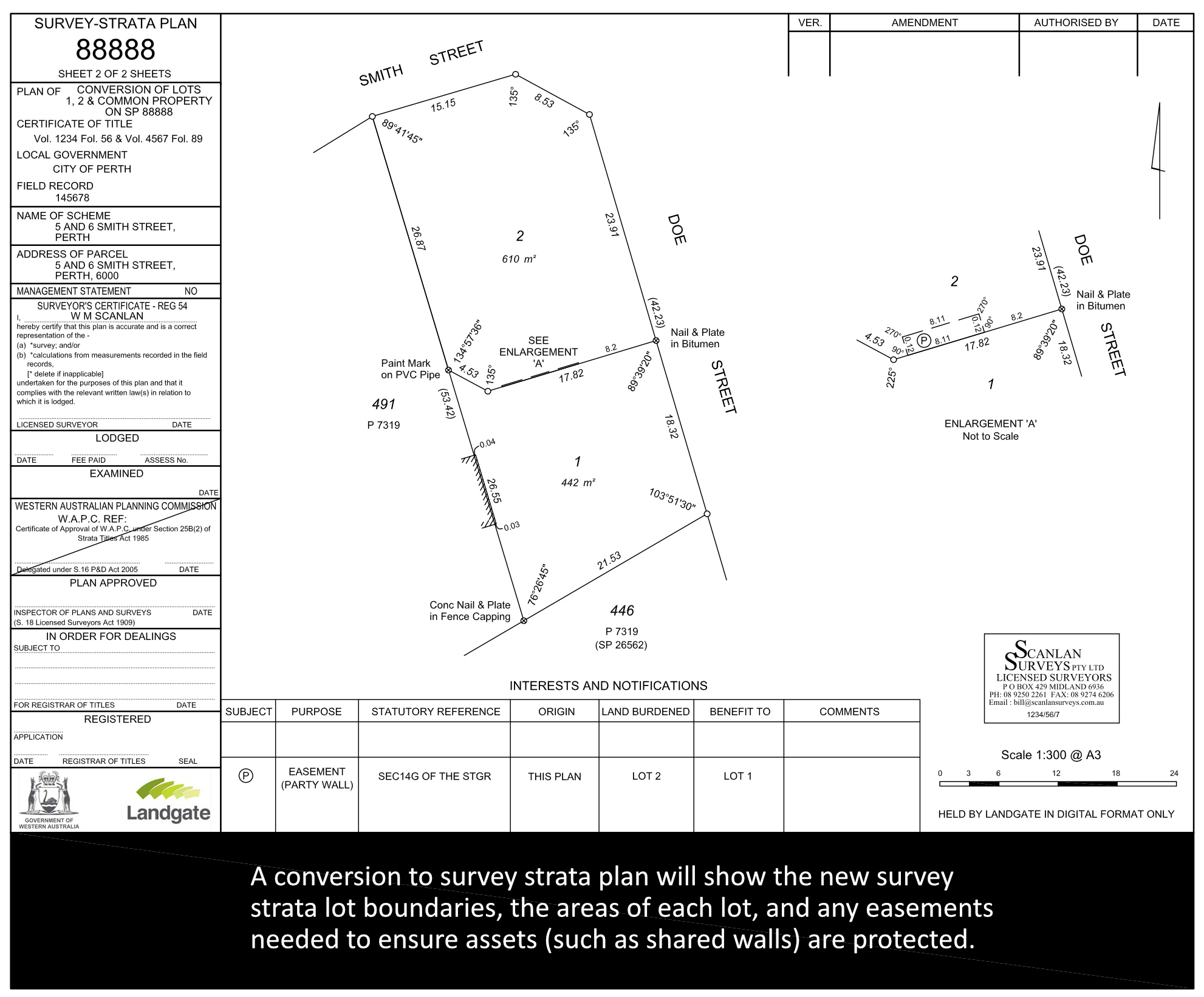
- Conversion to Survey Stratas
- Merge Stratas
- Building Set Out Surveys
- As-Constructed Surveys (road, sewer, water)
- Mining Tenements
- PCA Lease Surveys
- Easement Only Deposited Plans
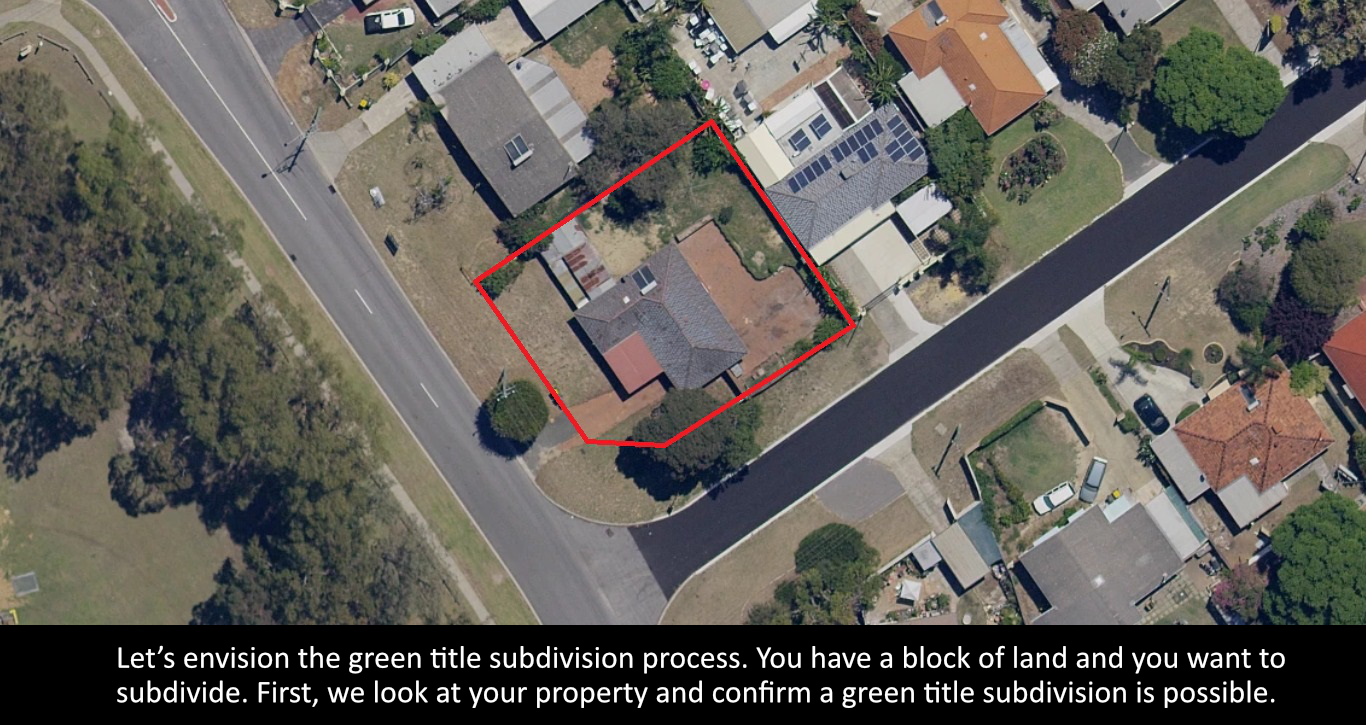
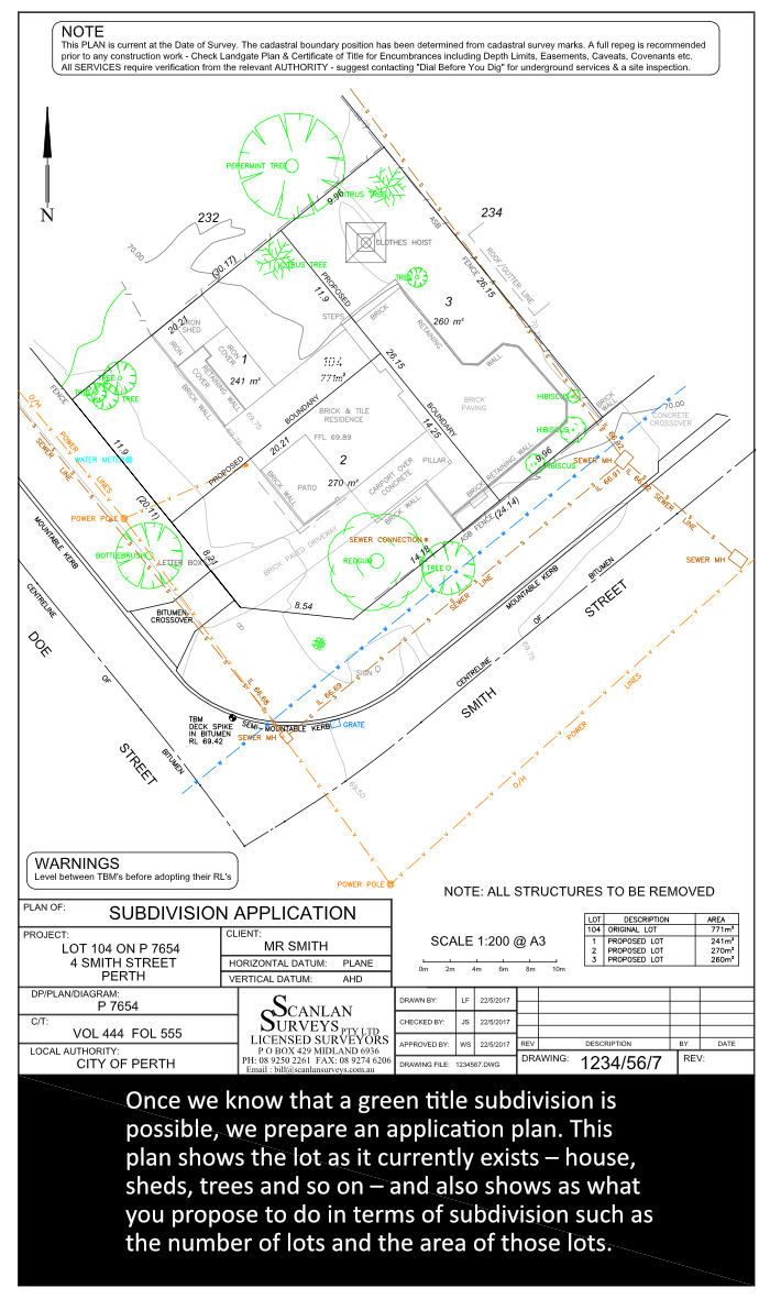
Green Title Subdivision
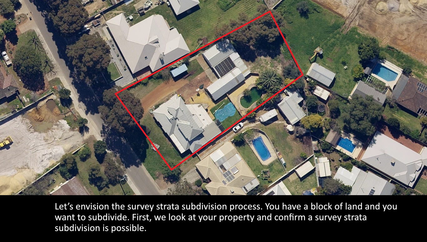
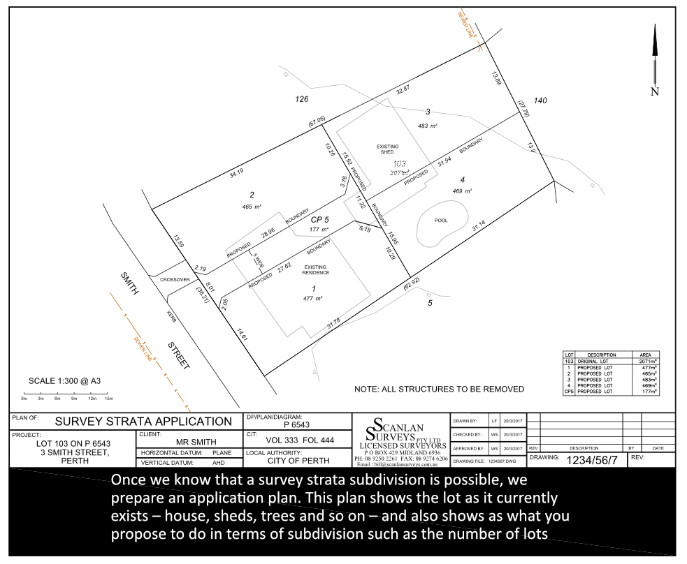
The position of services on a property, together with the Residential Design Codes, will determine whether you are eligible for a green title subdivision. Depending on certain factors, a green title subdivision may not be possible, but a survey strata subdivision might be.
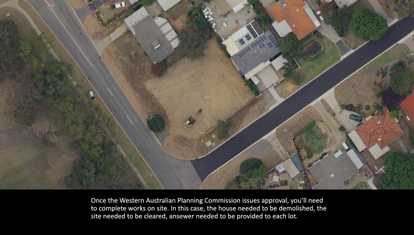
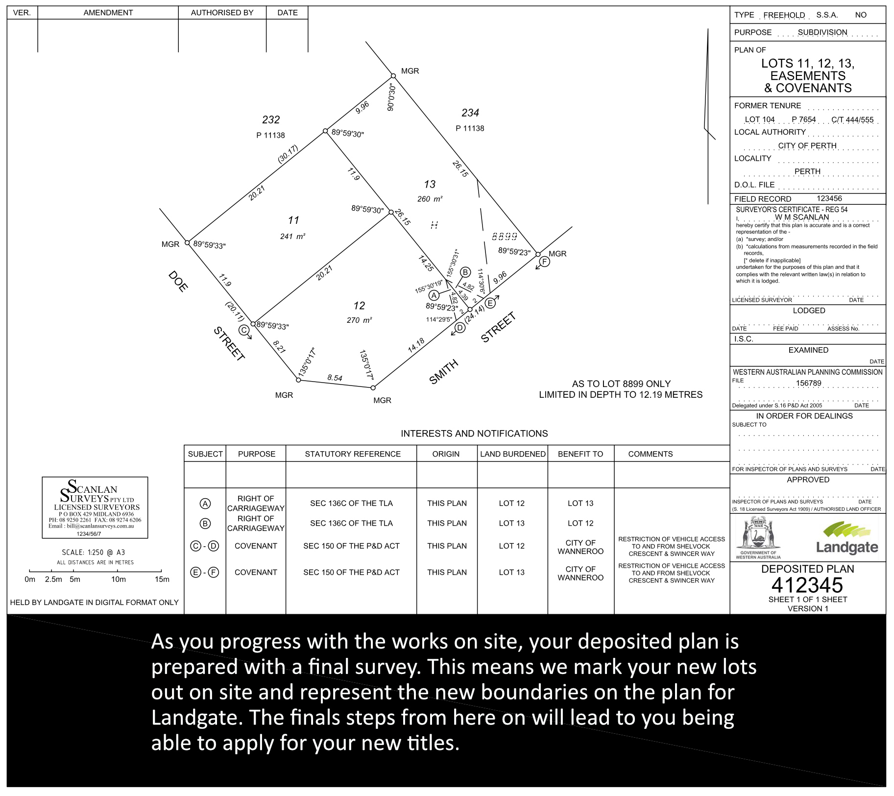
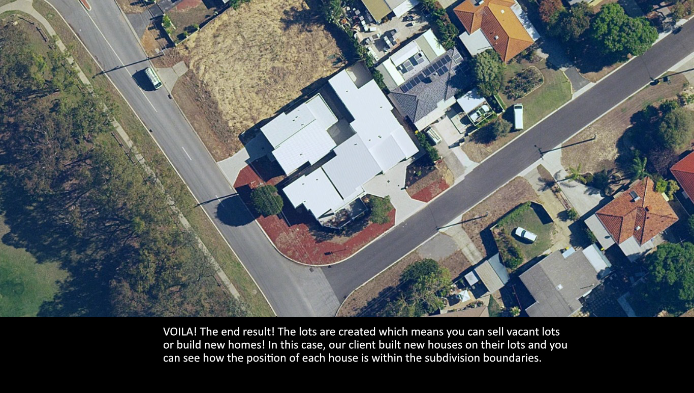
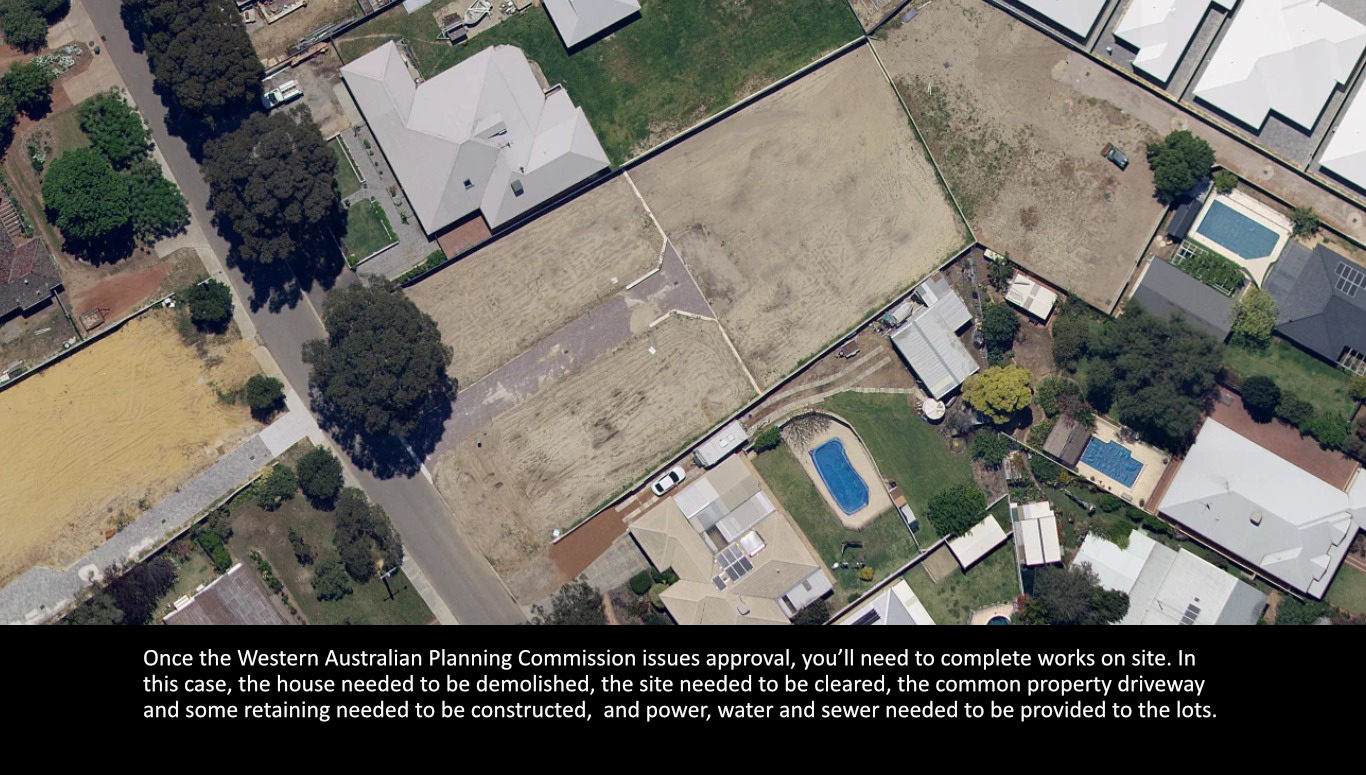
The green title subdivision process starts by lodging an application to the Western Australian Planning Commission. The Western Australian Planning Commission will liaise with various servicing authorities, such as your local council, the Water Corporation and Western Power, to provide comments on your subdivision application. The Western Australian Planning Commission processes these comments from the servicing authorities over ninety days and will issue a decision letter with a set of conditions which must be completed prior to obtaining the new titles.
Survey Strata Subdivision
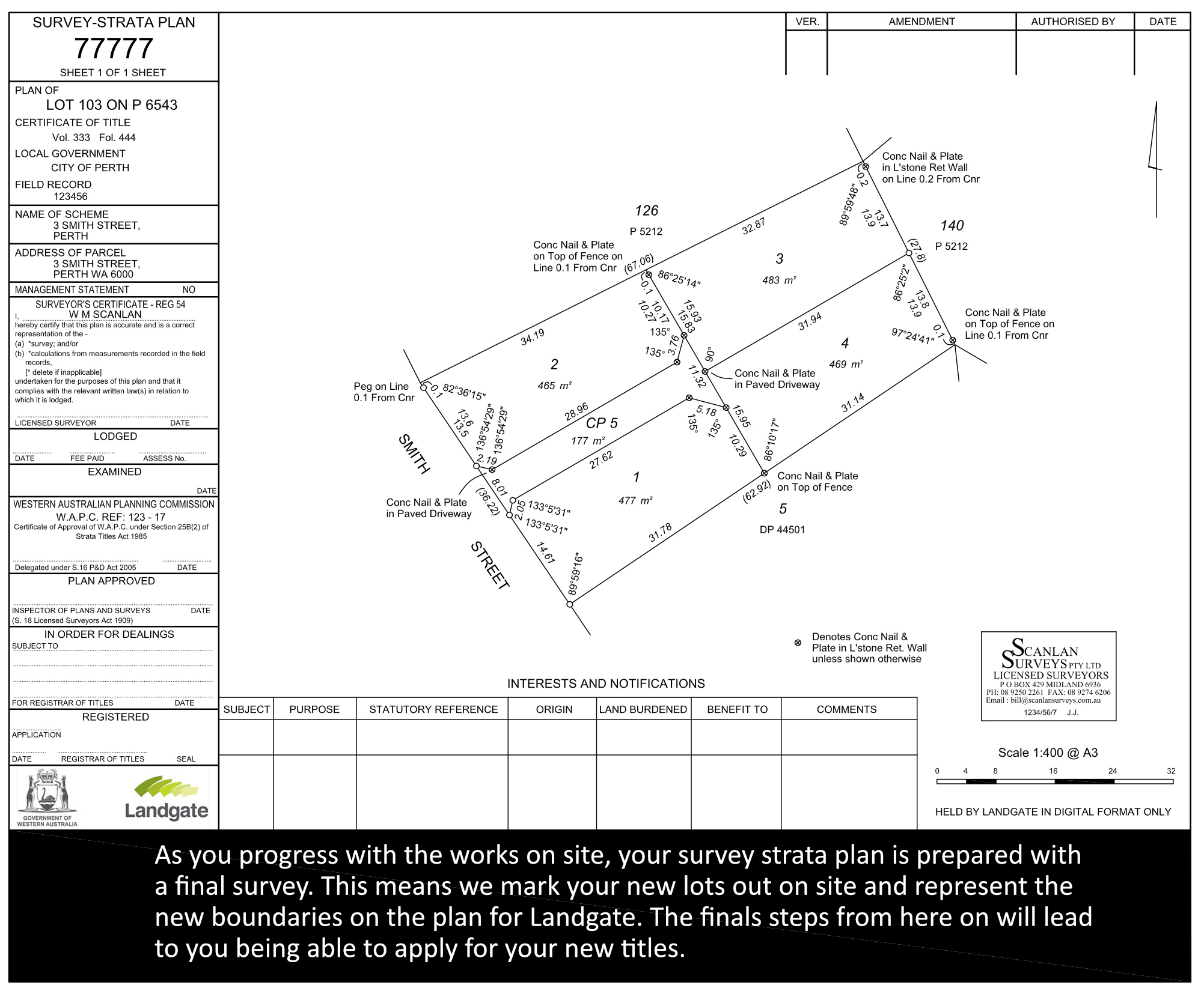
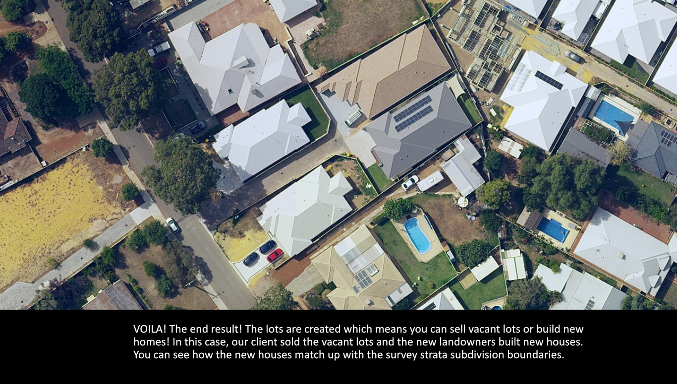
A survey strata subdivision allows services to cross lot boundaries. This means that internal service connections for power, water and sewer can be brought through one lot in order to service another. This is vastly different from a green title subdivision as with a green title, each lot must have its own direct connection to a service which does not cross through a lot boundary. It is important to consider the position of services when looking at green title vs survey strata and our office can provide information to help you make an informed decision for your subdivision.
The survey strata subdivision process starts by lodging an application to the Western Australian Planning Commission. The Western Australian Planning Commission will liaise with various servicing authorities, such as your local council, the Water Corporation and Western Power, to provide comments on your subdivision application. The Western Australian Planning Commission processes these comments from the servicing authorities over ninety days and will issue a decision letter with a set of conditions which must be completed prior to obtaining the new titles.
Some landowners may consider doing a built strata instead of a survey strata. When looking at a built strata vs a survey strata, one significant difference between the two options is that buildings are not required to be shown on a survey strata plan whereas they are required to be identified in full on a built strata plan. A survey strata is more advantageous in this regard as if you make any modifications or improvements to a building on a strata plan, the strata plan must be revised/updated.
Built Strata/Strata Survey
The built strata process uses existing buildings, carports, driveways, fences, and other features to define the lot boundaries on the strata plan. The area of each lot shown on a strata plan includes the main building and allocates land outside the building within the lot boundaries. This ensures that the usable areas for each lot are identifiable on the strata plan.For a built strata for four lots and under, an application is lodged with the offices of the local government. The process will involve obtaining unit entitlements from a licensed valuer and a certificate of building compliance from a building surveyor which are lodged with the application to the local government.The local government will process the application and will issue a building approval certificate. Once this certificate is received, the strata plan and the certificate will be lodged at Landgate. Once lodged at Landgate, the strata plan will be audited and eventually placed in an ‘in order for dealings’ status which means you are eligible to apply for the new strata titles.A built strata only requires an application to the Western Australian Planning Commission when it is for a development of five lots and more, or is a commercial or industrial development. When comparing built strata vs survey strata, one of the biggest differences is that on a built strata, the outline of the buildings is shown. On a survey strata plan, this is not a requirement. A built strata is a more time-efficient approach to obtaining separate titles where buildings are already constructed or are nearing completion; however, a survey strata may be more suitable to your property. If you would like to discuss built strata vs survey strata to find which best suits your subdivision needs, contact our office for more advice.
Conversion To Survey Strata
The process of a conversion to survey strata requires a signed Resolution by all landowners and there is a possibility that the existing unit entitlements will change. The conversion process is handled entirely through Landgate and does not require an application to the Western Australian Planning Commission or to the offices of the local government.
There are two forms – Forms 37 and 39 – which are required and our office will assist with the preparation and lodgement of these forms. The conversion to survey strata will require the consent of all mortgagees on these forms in order to proceed. Mortgagees will generally support the conversion to a survey strata as a survey strata is considered to be more advantageous than a built strata.
Once these forms are completed and once the new survey strata plan has been prepared, the forms and the plan will be lodged at Landgate where the conversion process will begin. Landgate will automatically convert the titles to a survey strata; you will not be required to lodge a new application for titles. The conversion to survey strata is a process which can only be completed on built stratas which were approved prior to January 1, 1998. Any built stratas approved after this date are ineligible to complete the conversion to survey strata process.
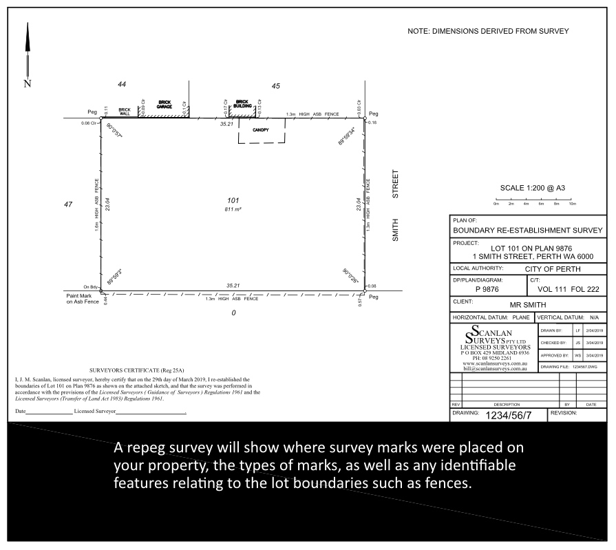
Repeg Survey
There are several reasons why you may need a repeg survey, also known as a cadastral survey or a boundary survey, on your property.
Over time, the survey marks on your property which help you identify your lot boundaries may disappear. This can be for any number of reasons including the age of the last survey conducted at your property, works on site displacing pegs, or natural elements causing your pegs to shift out of position.
You may need a repeg survey when you are building, setting out a building, installing a new fence or are organising a new power dome and want to make sure everything goes in the correct position.
Another reason you might want a repeg survey is that you believe an existing fence has been put in the wrong position, or a neighbour’s building has been constructed inside your property, and you want to confirm this with a survey.
A repeg survey will help with all of these items. Our repeg surveys can be conducted on just one boundary, multiple boundaries or all lot boundaries, depending on what you need. When we complete the boundary survey, we generate survey report which shows the results of the survey.
If you’ve been asked to complete a boundary survey, contact our office for more information. Our surveyors can offer advice on your survey requirements and we tailor our quote and survey to your needs
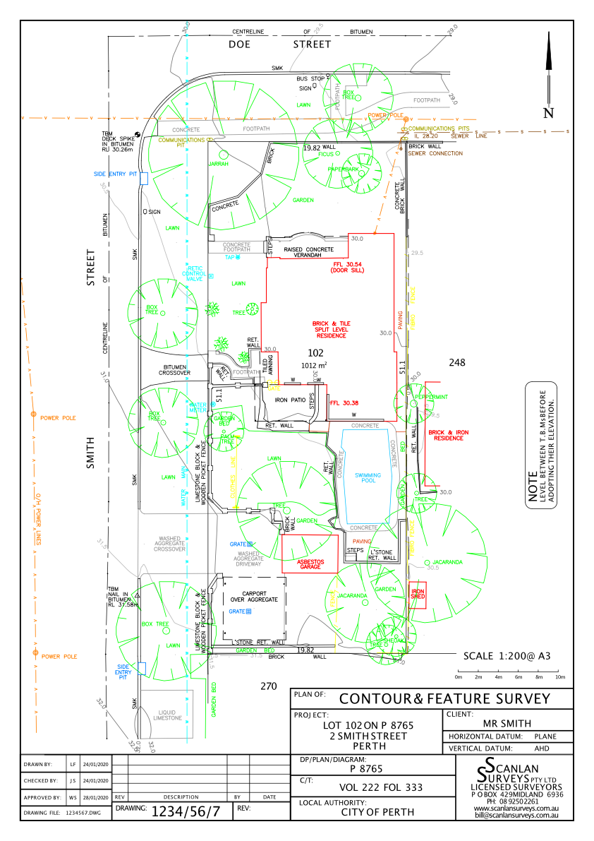
Contour and Feature Survey
A contour and feature survey, also called a site survey, shows the levels and features of your property in detail. The contour survey information on your plan will show your lot levels and spot heights which assists builders and architects with their designs. The feature survey component locates information on site including the existing residence, the position, size and types of vegetation on site, the locations of certain services such as power domes and water meters, assorted features such as garden beds and paved areas, and external structures such as sheds, water tanks, and more.
Our contour and feature surveys are designed to be informative and assist you with your project, whether you are building something new, improving on an existing home, adding an extension, or are completing any works where the site information is essential to know.
A contour and feature survey can be completed over a portion of your property or over the entirety of a lot depending on what you need for your project. Our survey reports are generated in PDF, DWG and DXF formats which means your builder/architect will be able to use our property survey in a variety of ways to assist with their design process. Our land surveyors can offer advice on your survey requirements and we tailor our quote and survey to your needs.